|
|
|
|
|
|
|
|
This year has turned out completely different from years past.
We wanted to go back and try something we did in the past, that is
launch further North from Burnt Store Marina and revisit places we
hadn't been to in awhile. Things got off to a rough start when we
were informed that long term parking was no longer an option at Burnt
Store Marina. We were referred to Pineland Marina on Pine Island.
I had done some research and knew about them, but they were not my
first choice.
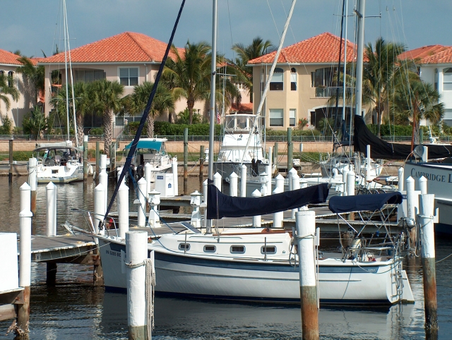 We
launched from Pineland Marina and went back to Burnt Store for a
couple of nights before heading to Cayo Costa. We
launched from Pineland Marina and went back to Burnt Store for a
couple of nights before heading to Cayo Costa. |
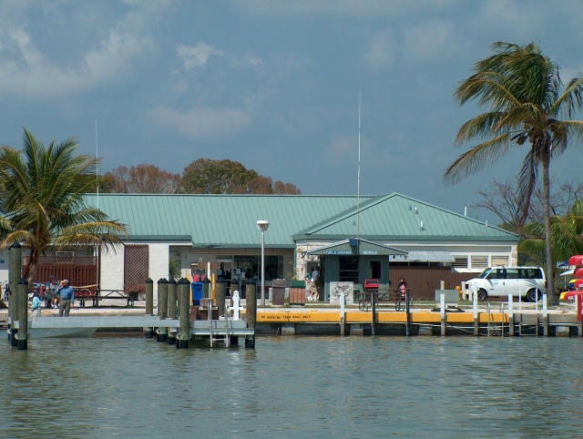
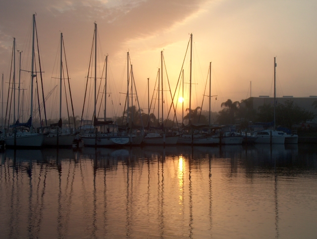 Caught
a great picture of the marina during sunrise one foggy morning. Caught
a great picture of the marina during sunrise one foggy morning. |
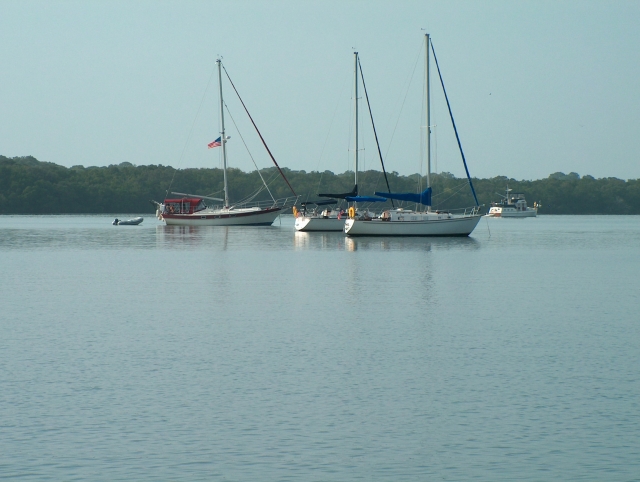 There
were quite a few other boats anchored here for the weekend. There
were quite a few other boats anchored here for the weekend. |
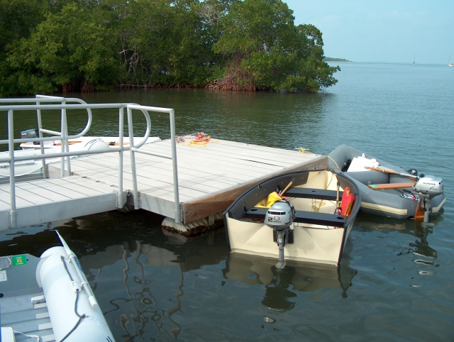 The
dinghy dock was kind of confusing since they had signs all over "for
service boats only", but the ranger cleared that up and we happily tied
up to the floating dinghy dock. The
dinghy dock was kind of confusing since they had signs all over "for
service boats only", but the ranger cleared that up and we happily tied
up to the floating dinghy dock. |
 We
explored Cayo Costa and saw a wild boar piglet crossing the trail ahead
of us. We knew its mother wasn't far behind and didn't want to
provoke it so we moved on. We
explored Cayo Costa and saw a wild boar piglet crossing the trail ahead
of us. We knew its mother wasn't far behind and didn't want to
provoke it so we moved on. |
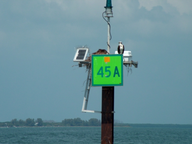
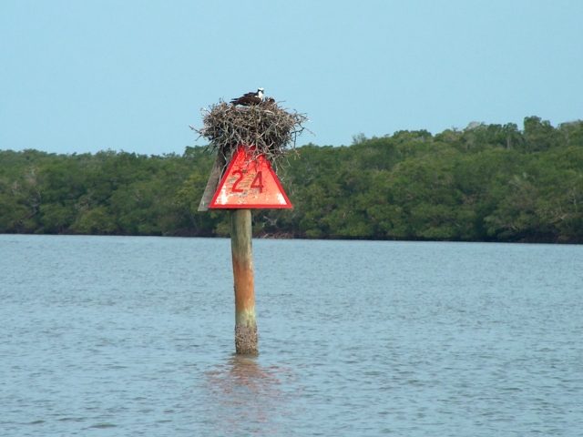
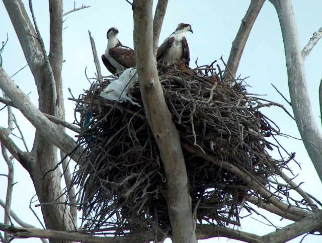 On
the East side, near quarantine point, we spotted an Osprey nest.
Usually the only ones we see are out on the markers along the ICW. On
the East side, near quarantine point, we spotted an Osprey nest.
Usually the only ones we see are out on the markers along the ICW. |
 They
had erected several signs like this near the dock. The area was
closed while they completed some construction in the area. They
had erected several signs like this near the dock. The area was
closed while they completed some construction in the area. |
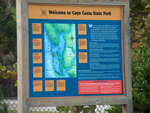
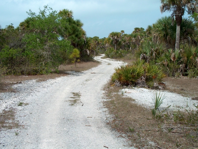 There are trails like this on the island. There is a map showing all the
trails.
There are trails like this on the island. There is a map showing all the
trails. |
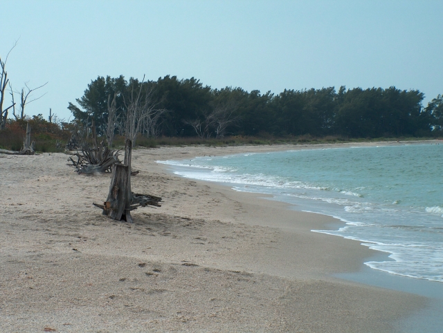 We
walked from the dock area to the Gulf side and through the campground
to the beach. We
walked from the dock area to the Gulf side and through the campground
to the beach. |
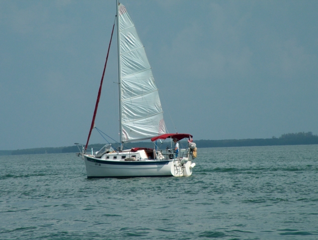 Spotted
another Seaward 25 headed North while we were headed South, towards
South Seas Plantation Spotted
another Seaward 25 headed North while we were headed South, towards
South Seas Plantation |
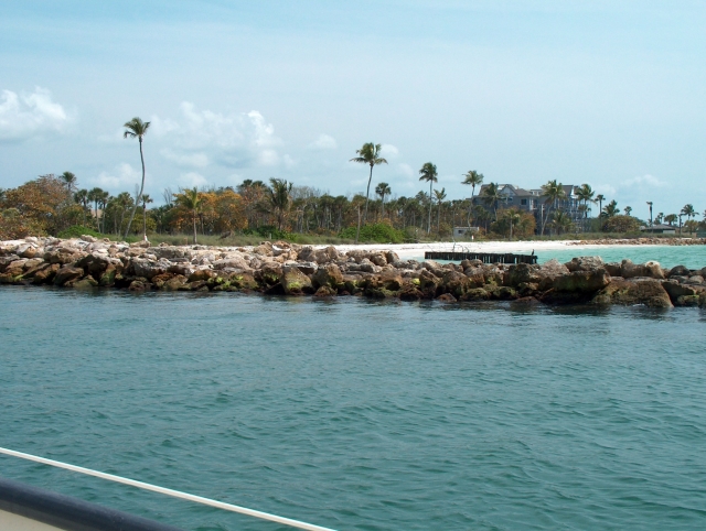
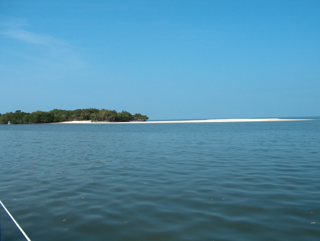
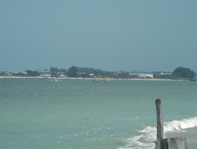 Gasparilla
Island as viewed from Cayo Costa. The lighthouse here is
different than the conventional lighthouse in that it looks more like a
regular house with a light added on top. Gasparilla
Island as viewed from Cayo Costa. The lighthouse here is
different than the conventional lighthouse in that it looks more like a
regular house with a light added on top. |
 We
gave South Seas Plantation a call on the radio for overnite dockage,
but they were full. We hadn't been out Redfish Pass in awhile so I
called TowBoat US and asked for local knowledge about the pass. They
confirmed what I suspected, so we headed out the pass into the Gulf. We
gave South Seas Plantation a call on the radio for overnite dockage,
but they were full. We hadn't been out Redfish Pass in awhile so I
called TowBoat US and asked for local knowledge about the pass. They
confirmed what I suspected, so we headed out the pass into the Gulf. |
| After rounding the
southern tip of Sanibel Island it started getting dark. We took
sails down and motored behind Sanibel island just outside the entrance
to Sanibel Marina and dropped anchor for the night. Everything was
fine until about 11 PM when the tide turned and started running against
the wind. We were tossed and turned every which way until about 3
AM when things started to finally settle down. |
|
 From
Sanibel we headed across San Carlos Bay and headed for Fort Meyers
beach. We waited for the gambling boat to leave before entering
the channel. From
Sanibel we headed across San Carlos Bay and headed for Fort Meyers
beach. We waited for the gambling boat to leave before entering
the channel. |
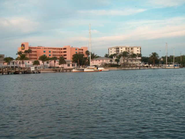
 Called
ahead to Moss Marine for a slip and they gave us directions in and a
slip assignment (B-8). Access between A and B docks is blocked
once a week while refueling the gambling boat. Called
ahead to Moss Marine for a slip and they gave us directions in and a
slip assignment (B-8). Access between A and B docks is blocked
once a week while refueling the gambling boat. |
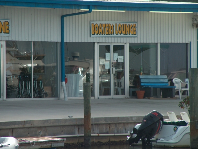 It
doesn't get any better than this. The lounge has TV, coffee,
laundry and several shower rooms. Everyone was very friendly and helpful. It
doesn't get any better than this. The lounge has TV, coffee,
laundry and several shower rooms. Everyone was very friendly and helpful. |
 From
Fort Meyers we headed south to Naples. This picture is the rock jetty
on the right side of the pass. From
Fort Meyers we headed south to Naples. This picture is the rock jetty
on the right side of the pass. |
 From
Gordons Pass we motored up to Naples harbor. They have a speed
limit on weekends and it can get rough when the big boats don't slow
down. From
Gordons Pass we motored up to Naples harbor. They have a speed
limit on weekends and it can get rough when the big boats don't slow
down. |
We stayed at Naples city dock
for a night and then headed back out into the Gulf and headed south to
Capri Pass and Marco Island. Had a good but short sail and motored
on the inside down to Goodland. Wind was on our nose again so we
motored sailed to Dismal Key and anchored for the night. |
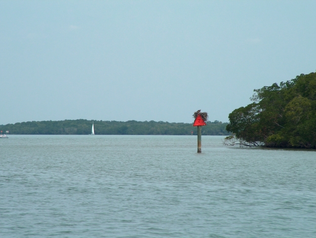
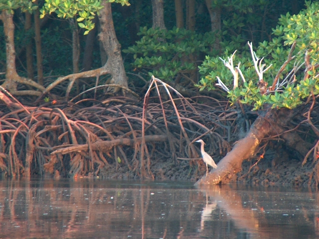
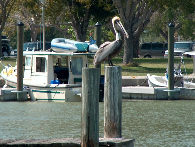
 Almost
every daybeacon in this area has an osprey nest on it. Almost
every daybeacon in this area has an osprey nest on it.From Dismal key south, the no-see-ums were a problem unless the wind was strong enough to keep them away. |
 This
is the Eastern tip of Indian key as we left our anchorage in Russel
Pass near Everglades City. We then spent a night anchored behind
New Turkey key before heading to Shark River. This
is the Eastern tip of Indian key as we left our anchorage in Russel
Pass near Everglades City. We then spent a night anchored behind
New Turkey key before heading to Shark River. |
 Once
in the Shark River we motored up to Oyster Bay and spent
the night. Anchoring in the river requires two anchors, but once in the
bay you only need one anchor. Once
in the Shark River we motored up to Oyster Bay and spent
the night. Anchoring in the river requires two anchors, but once in the
bay you only need one anchor. |
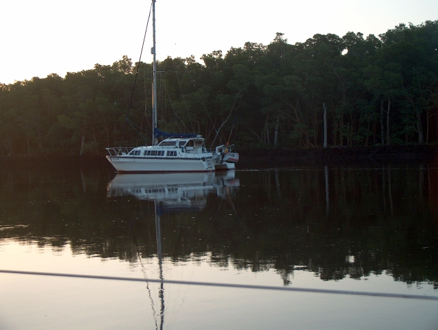 On
the way down there weren't any other boats in the river when we went in
and only saw a couple of boats on the way out the next day. On the
way back a week later there were several boats like this anchored in the
river. On
the way down there weren't any other boats in the river when we went in
and only saw a couple of boats on the way out the next day. On the
way back a week later there were several boats like this anchored in the
river. |
 When
we got to Flamingo Marina there was a large Motor Yacht taking on
diesel fuel. Rather than wait we went and pulled into an empty
slip. Turned out he took on 300 gallons of diesel fuel.
@$600+ When
we got to Flamingo Marina there was a large Motor Yacht taking on
diesel fuel. Rather than wait we went and pulled into an empty
slip. Turned out he took on 300 gallons of diesel fuel.
@$600+ |
 There
were not very many boats here compared to previous couple of
years. Mosquitoes were not that bad, but it was a lot warmer than
normal for this time of year(mid-March). Record high temperatures
in Miami and other cities nearby were broken. There
were not very many boats here compared to previous couple of
years. Mosquitoes were not that bad, but it was a lot warmer than
normal for this time of year(mid-March). Record high temperatures
in Miami and other cities nearby were broken. |
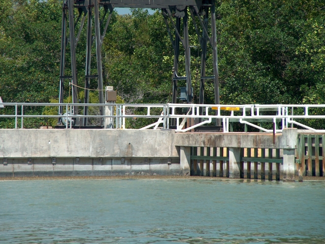 This
concrete "dam" is known as the "plug" in Flamingo. On the other side of
it is the Buttonwood canal which leads north to Coot bay. There is
a lift which can move boats from the salt water side to the fresh water
side and vice versa. When the canal was first dug tidal waters
moved up and down the canal and the environment started to change
because of the salt water finding its way up the canal and into
Whitewater Bay. This
concrete "dam" is known as the "plug" in Flamingo. On the other side of
it is the Buttonwood canal which leads north to Coot bay. There is
a lift which can move boats from the salt water side to the fresh water
side and vice versa. When the canal was first dug tidal waters
moved up and down the canal and the environment started to change
because of the salt water finding its way up the canal and into
Whitewater Bay. |
|
From here we made our way back North and pulled the boat back out of
the water a couple of days earlier than planned due to a cold front that
was approaching with more rain. Most of the rain we encountered
happened at night. We stayed at Moss Marine while one front
passed. Severe thunderstorms passed just to the North and a
tornado hit near Naples to the South that day. We decided we may
cruise a different area during the next el Nino. Next year we plan
to start where we left off and sail from Flamingo to the middle Keys.